Using Satellite and Cell Phone Data to Eliminate Malaria in Namibia
DATA
Researchers use satellite and cell phone data to map how malaria spreads throughout Namibia and show where elimination efforts have the greatest impact
IMPACT
Identified and provided bednets to the 80,000 people most important to the malaria transmission cycle in 2013
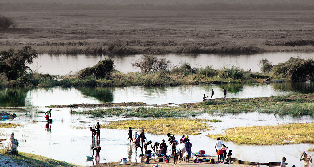
Photo: Christopher Lourenço, “Untitled,” Okavango River, Namibia. Creative Commons BY license obtained; available at https://creativecommons.org/licenses/by/4.0. Used with permission.
Namibia has made great progress in the fight against malaria. For complete elimination, however, health officials need better data on how people transmit malaria as they travel between communities. A combination of satellite and cell phone data is making this p ossible: satellite images map the environmental conditions in which malaria parasites and mosquitos are abundant, and cell phone records are used to anonymously track population movements. Together, the two types of data allow detailed mapping of malaria transmission in Namibia, and allow interventions like bednet distribution to be optimally targeted to disrupt the infection cycle.
From Reducing to Eliminating Malaria
Between 2004 and 2011, annual malaria cases in Namibia dropped 98 percent, from over six hundred thousand to just 14,400. To completely eliminate the disease, health officials must now locate isolated cases, a challenging task that lies beyond the capability of traditional data systems.
Geographic Causes of Malaria Risk
Using satellite images, researchers drew maps of environmental factors like vegetation density, population, and rainfall that affect mosquito and parasite populations and the likelihood of transmission. This information was then used to infer risk of malaria infection at high spatial resolution throughout northern Namibia.
Mapping Mobility with Cell Phone Data
As infected people move between communities, they carry the malaria parasite in their blood. To reconstruct travel patterns, Namibia’s largest network provider, Mobile Telecommunications Limited, shared anonymized cell phone records of 1.2 million users from 2010-11 with researchers at the Flowminder Foundation and the University of Southampton in the United Kingdom. As calls are made, the locations of the cell towers through which signals pass are recorded. Call frequencies and locations then allow researchers to create detailed maps of human movement. 1
Targeted Intervention
In 2013, Namibia’s Ministry of Health, supported by the Global Fund and the Clinton Health Access Initiative, used the mobility and malaria risk maps to target bednet distribution to key areas. Instead of the daunting challenge of immediately covering 1.2 million people – the previous estimate of the population at risk – the health system used its limited resources to first reach the 80,000 people most important to the malaria transmission cycle.2 3
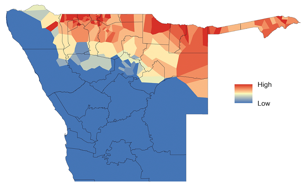
A geographical heatmap of the potential effectiveness of interventions, constructed using a combination of satellite and cell phone data. Controlling malaria in the red areas has the greatest impact on stopping the spread of infection. Source: Tatem et al. 2014
Graphic: From reference [1] above, used with permission from the authors.
References
1. Tatem, Andrew J, Zhuojie Huang, Clothilde Narib, Udayan Kumar, Deepika Kandula, Deepa K Pindolia, David L Smith, Justin M Cohen, Bonita Graupe, Petrina Uusiku, and Christopher Lourenço. 2014. “Integrating Rapid Risk Mapping and Mobile Phone Call Record Data for Strategic Malaria Elimination Planning.” Malaria Journal 13 (accessed May 1, 2015). doi:10.1186/1475-2875-13-52.
2. Lourenço, Christopher. 2014. Clinton Health Access Initiative. Interview by Bapu Vaitla. Phone interview. February 13, 2014.
3. Didier, Bradley. 2014. (Clinton Health Access Initiative). Interview by Bapu Vaitla. Phone interview. February 19, 2014.